Black Diamond. The internet is full of loopholes and leaks
Posted in: Uncategorized

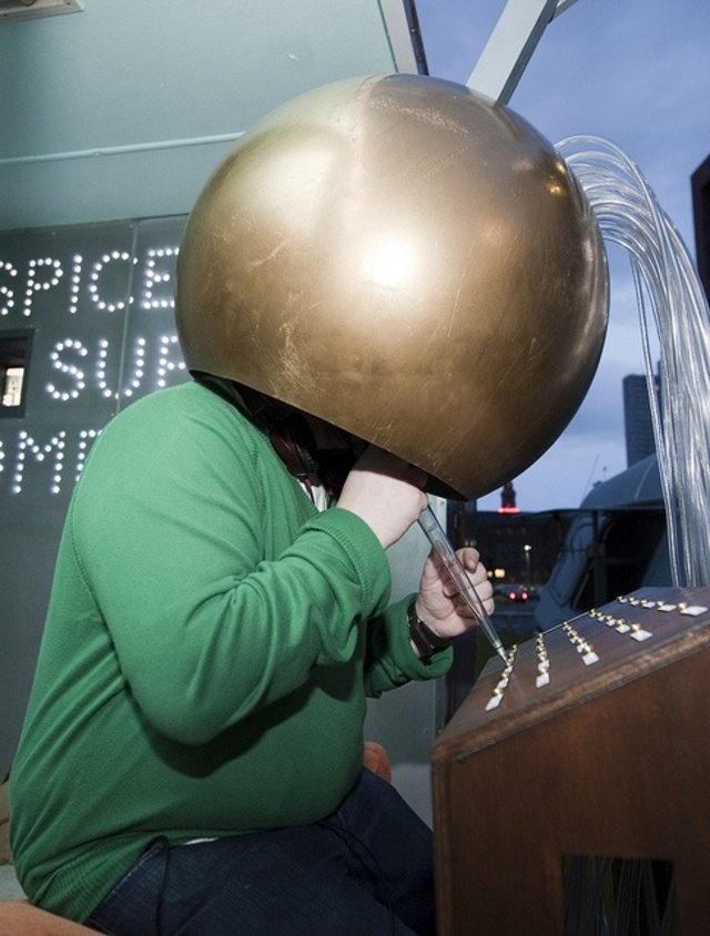
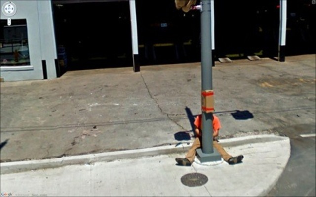
Jon Rafman was one of the first artists who spent hours looking at the images collected by the cars and searching not just for the amusing, the ridiculous and the fortuitous but for postcard perfect moments. And does he have an eye for stunning images… continue
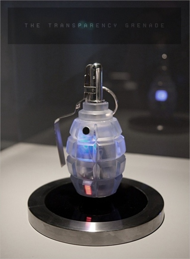
Presented in the form of a Soviet F1 Hand Grenade, the Transparency Grenade is an iconic cure for these frustrations, making the process of leaking information from closed meetings as easy as pulling a pin continue
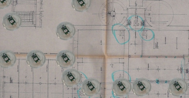
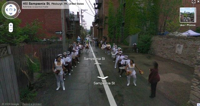
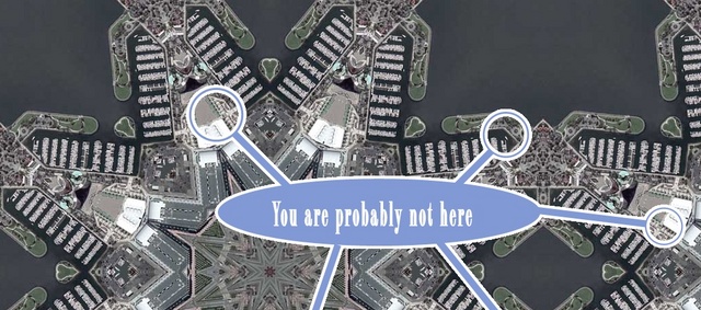
The largest part of the pharmaceuticals and chemicals we take go through our bodies and eventually end up in waste water. As water and waste treatment plants haven’t been designed to filter them, the content of our medicine cabinets are eventually passed into the water supply. In London, tap water comes from surface water which implies that traces of our medicine can end up in our drinking water. This results in local differences in tap water, based on the food and drugs we ingest.
Tuur van Balen, one of the graduates of Design Interactions at the RCA, decided to explore this issue in a project which imho had the perfect balance between speculation and solid anchorage into reality.
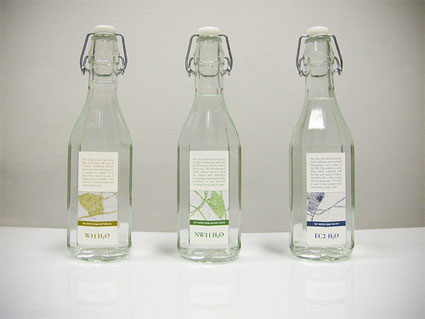
The way people live and behave in each zone of London can be reflected in the quality of the tap water. Tap water in London Notting Hill very probably benefits from the high density of organic shops found in the area. Tap water in the city of London is presumably enhanced with all kinds of stimulants, from caffeine-rich drinks to cocaine. Golders Green which houses an important Jewish community can be expected to ‘produce’ a very fertile water due to the low concentration of people taking anti-conception pills.
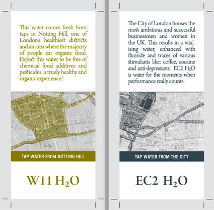
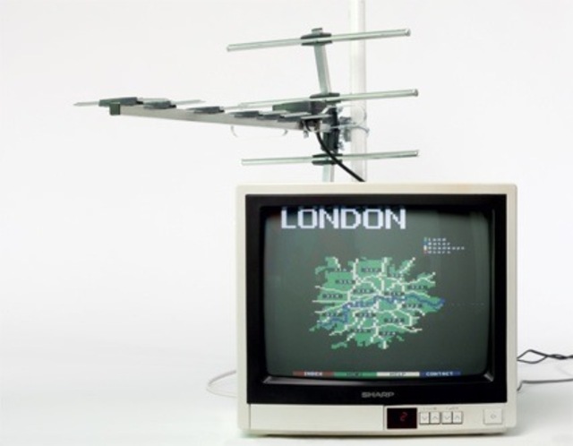
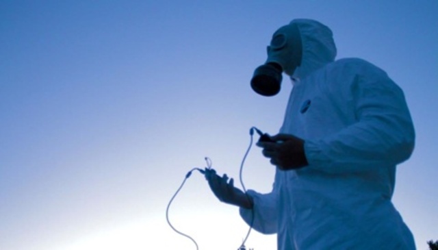
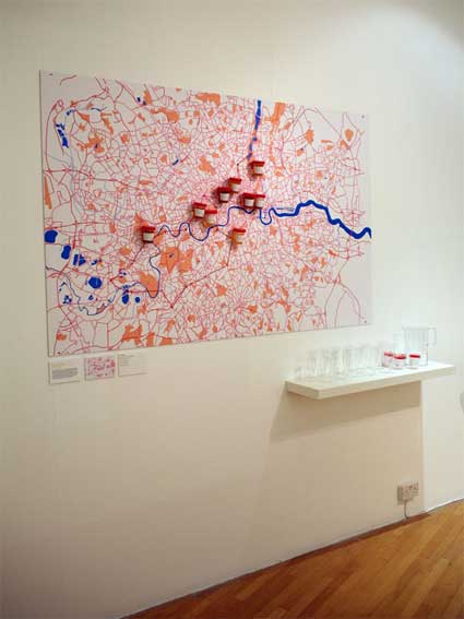
Back in January, at the opening of the department work in progress show, Tuur presented My City = My Body, the first chapter of this research into future biological interactions with the city and more precisely into how the increasing understanding of our DNA and the rise of bio-technologies will change the way we interact with each other and our urban environment. He offered tap water to the visitors of the show and asked them to donate a urine sample along with their postcode. The samples, their biological information and postcodes were then added to a map of London which reveals potential local city-body ecologies or biotopes.
The next step is a website which helps London inhabitants describe, speculate on, map and share what they think are the unique characteristics of their tap water. The map thus created reveals potential local city-body ecologies, or biotopes. The system will also generate a custom-made label which you can download if you want to sell your own tap water.
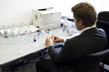
Filling the bottles in the City…
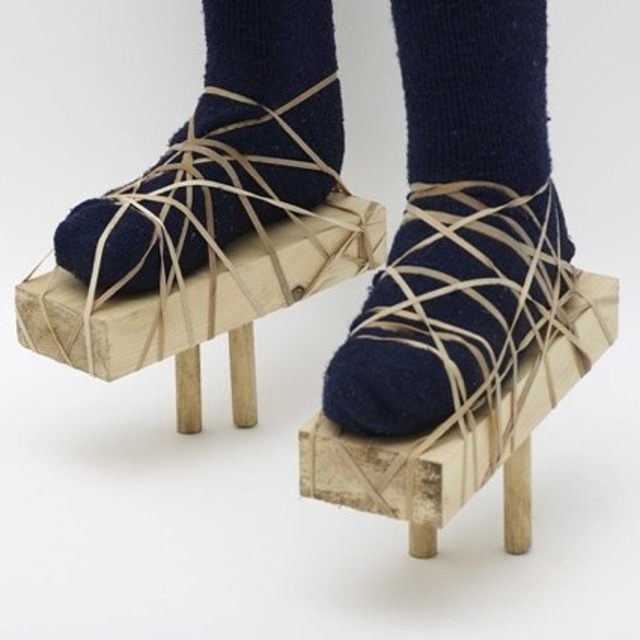
That’s what the designer did. He went to the hip and organic-addicts frequented Broadway market in Hackney to set up a stall, offer people to “buy” bottles of tap waters, branded with the London area they came from and engage in a discussion about the possibility of new urban biotopes.
selling tap water on Broadway Market from Tuur Van Balen on Vimeo.
You can find various websites which details the quality of various tap waters. But most of the systems employed to analyze water do not check for say, anti-depressant substances or cocaine. What if biotechnology could provide us with cheap detectors?
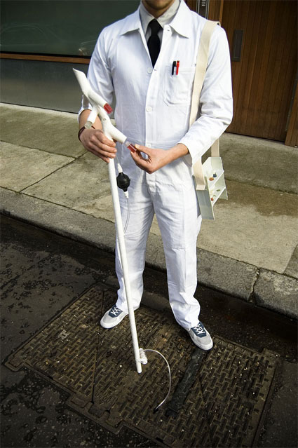
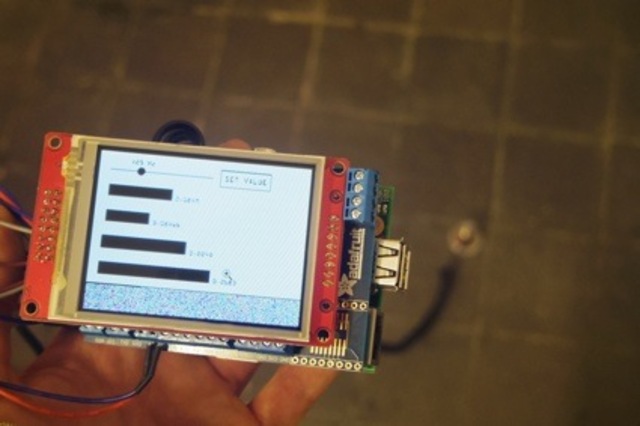
With the help of bioengineer James Chappell, Imperial College, Tuur developed the concept for a Urban Biogeography tool. The instrument would enable anyone to study the distribution of urban biodiversity over space and time by monitoring sewage. With the tool, a tiny amount of sewage can be pumped up and scaned for different pharmaceutical and chemical traces, without having to lift a manhole cover.
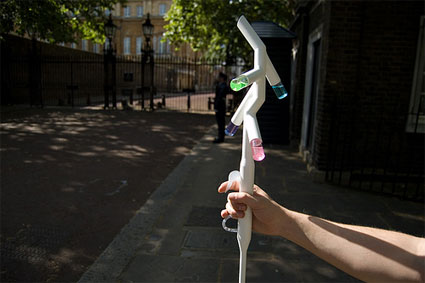
Using synthetic biology and in particular the biobricks tools, bacteria are programmed to become cheap biosensors. The bacteria-sensors, housed in the small transparent compartments, change colour when oestrogen, antibiotics, Viagra or Prozac are detected in the water. Since synthetic biology is both open source and modular, this instrument can be redesigned to detect other chemicals by any Urban Biogeographer, even amateurs as the technology is becoming increasingly accessible. The set of data thus obtained can be used to influence healthcare or property prices in the area, that of course would be the ideal scenario…
All images courtesy of Tuur van Balen.
Related: 24c3: Programming DNA – A 2-bit language for engineering biology, Designer Microbes.
I’m back from Asturias which was as lovely as ever. We even had real vegetable to eat this time. The LAboral Art and Industrial Creation Centre in Gijón was opening Banquete_nodos y redes, Interactions Between Art, Science, Technology and Society in Spain’s Digital Culture, an exhibition initiated by Karin Ohlenschläger and Luis Rico.
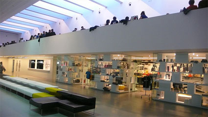
View of the LABoral shop and of the inauguration party right above it
The press conference started with a string of surprising figures listed by LABoral’s Director Rosina Gómez-Baeza Tinturé. In its 14 months of activity, the centre -which has given itself the mission to foster the interaction between art, society and technology- has hosted the work of 261 creators (45 of them come from the region of Asturias), 54 workshops given by some 90 teachers to more than 3000 participants. Add to that many concerts, conferences, debates and other activities. Amazing, even for a space that covers more than 14.000 m². Which reminds me that it would be good to come back one day on the design and architecture of the centre. The public bathrooms only are worth the visit, i feel like stepping inside 2001: A Space Odyssey each time i enter there.
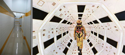
LABoral bathroom and a scene from 2001: A Space Odyssey
Banquete_nodos y redes presents more than 30 digital and interactive works that critically and creatively explore the notion of Network as a shared matrix, not just from a technological perspective but also from a socio-cultural perspective. I’ll be back with a lengthier overview of the exhibition and a small interview with its curator, the art critic Karin Ohlenschläger, later on but right now i wanted to share with you one of the best projects i saw in Gijón last week.
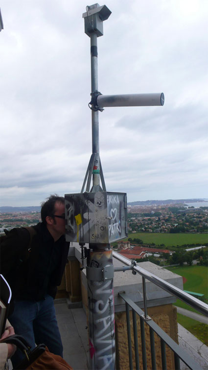
You’ve probably read about Clara Boj and Diego Diaz before, either in some media art catalog or on this blog, i interviewed them a few months ago about their project AR Magic System, their Lalalab studio and their interest for the visualization of wifi networks.
For the LABoral exhibition, the Valencia-based duo developed a sightseeing telescope named Observatorio (Observatory).
Observatorio builds upon Boj and DIaz’ 2004 project Red Libre Red Visible (Free Network, Visible Network) which was born in an optimistic time when it seemed possible to achieve an utopia made of wireless, open communication networks managed by social groups offering services to the local community. At that (not so distant) time, several city governments offered free access to the WiFi network, sometimes in the entire city. The CMT (Telecommunications Market Commission) denounced those city governments for unfair competition with telecom companies, the free wifi municipal projects were canceled, and grassroot groups started installing, maintaining and extending open WiFi networks throughout Spain.
Today, some companies have adopted new tactics based on the deceptive slogan “Share your WiFi”. Companies like FON, and commercial projects such as Whisher and Wefi exploit the current infrastructure of access nodes to the Internet in urban space to provide coverage to the whole city if it were an open, shared structure.
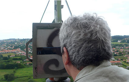
Obervatorio reflects on this scenario by informing viewers about the current state of wireless networks located in the area where the device is installed. The sightseeing telescope, installed on the Laboral tower, tracks and shows where Gijon’s wifi networks are located in real time. You can visualize them on the screen of the telescope, swing it around and see which areas have a denser wifi coverage, and get additional data such as which ones among these networks are open or private. Because Observatorio is programmed to try and connect to any open network available in the area, it can send the information from the observation tower to the exhibition hall, where it is displayed on a big screen. If there is no open networks detected in the area, Observatorio remains separated from the main exhibition space, located in another building. A modification of these networks is also offered, showing an ideal configuration in which the local residents of large areas in the city could gain or share access to it.
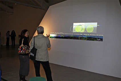
Image courtesy LABoral Centro de Arte y Creación Industrial
After having installed Observatorio, the artists discovered many more open nodes than they expected. While testing the project at their studio in Valencia, they couldn’t find more than 5% of open networks. In Gijón the percentage is higher, around 30% in the LABoral area.
From the tower Observatorio can reach theoretically almost the whole city of Gijón. The device comprises a high power uni-directional WiFi antenna with a 30º aperture, able to detect wireless networks within 1 to 4 kilometers depending on the number of obstacles encountered; a video surveillance camera with a telephoto lens with the same aperture as the WiFi antenna; and a viewer which, like a periscope, offers a real time image taken by the camera, with the WiFi networks detected by the antenna placed geographically on it.
Banquete_nodos y redes runs at LAboral Art and Industrial Creation Centre in Gijón, Spain, until November, 03, 2008. The exhibition will then travel to the ZKM | Center for Art and Media in Kartlruhe, March-July 2009.
More sightseeing telescope: The timetravel telescope, the Jurascope and the Elastic time and space telescope.
Also related: Wifi Camera Obscura.
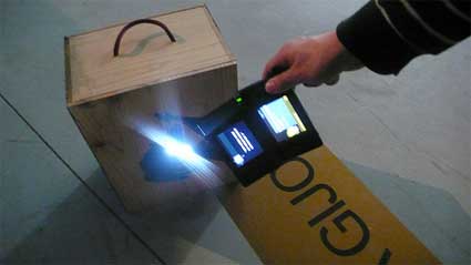
While i was at LABoral visiting the Homo Ludens Ludens exhibition, i got to live the uncanny experience of being bossed around by wooden boxes that deliver Situation(ist) quotes, order me to bring them to their friends (which were also boxy and made of wood), carry them upstairs within 30 seconds, and treat them like princesses. I felt like a puppet in the hands of Objects of Desire, the latest game of Ludic Society. This international association of artists, game practitioners and theorists seek to provoke a new artistic re/search discipline, best addressed as ‘ludics’ (cf. some of their previous works: Tagged City Play for Real Players in Real Cities and The Pong Dress).
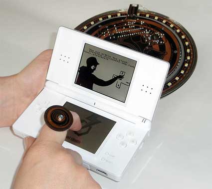
Objects of Desire is a Neo-Situationist’s walk in the company of capricious spimes through an invisible city of electromagnetic waves. The play-map constitutes of real names of wireless access points, found during a “WIFI-Sniff” through the city of Gijon. Names of actual urban WIFI zones (my favourite was called Familia Alvarez) are mapped and tagged like street-names in the exhibition space while aether waves with the same subjective names are also superimposed on the arts space, as playground.
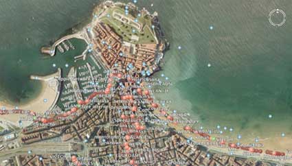
Instead of writing down what the game is about, i’ll just send you to the video of the game . It clearly explains the developments, mechanics and rules of the game. And because the plot unfolds in sunny Gijon and LABoral, you’ll also get an idea of what both the city and the art center are like.
I asked Ludite Margarete Jahrmann (who developed the game together with Fleshgordo, imonym, Rene Bauer,
and MosMaxHax) to give us more details about their game:
How does the game work technically? Does it use rfid?
Yes, each object is tagged with a RFID tag. Our self-built LS-Gerät can sniff each box and based on the RFID number and cabbalistic numerology rules the object’s desire will be appointed.
On the other side, we hide a couple of WIFI network clouds (some openWRT hacked linksys routers) in the exhibition space by which each player is located through the built-in WIFI function of Nintendo DS. The clouds are named and geographically located like access points in Gijon-city.
Basically, it is a very speculative motion tracking, like a triangulation with cell phones, virtual and real. Anyhow we used them as an inverse surveillance for each player. Each move is logged 😉
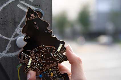
The Ludic extensions of SM (standard model) game consoles are extremely beautiful. How exactly do you craft them? Does each shape correspond to a particular function?
They were all DIY self-built and designed in our LSCV (Ludic Society Chapter Vienna). The design is conceptually connected to our ideas of a PCB – ‘Pata Circuit Boards – which are standing for Imaginary Machines and Devices of Wonder (read more about in issue#1 of LS magazine).
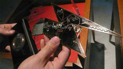
Each LS-Reader is equipped with a voltage booster, a Wunschmaschine, not only referring to our concept but also in Real by literally lifting the supply voltage up from 3 to 5 Volts. Each shape corresponds to a different conceptual starting point. The little tree refreshes the EM (electromagnetic) aether while the “Blitz” refers to our notion of BlitzPlay (Urban Guerrilla Street Play Tactics – TAZ). The circular shaped PCB is a sequel of our LudicWheel, a living machine, built for playing the game- and the reality engine either-way.
What is the story or motivation behind the objects’ stories and desires?
Playtarget: inverse surveillance by mobile toy-gadgetry…walks between WIFI and RFID waves-.. the city waves in Gijon – site specific metaphors…
Some parables between the electromagnetic waves of a city and the waves of the sea…
Then about the inverse control of objects by subjects – a domination and surveillance PlaySurVeillance 😉 by “Subjectivated” objects… with eeach RFID tag, the internet of
things gains more power. The boxes are just placeholder for any commodity or tagged object…
Based on what you could observe while you were in Gijon, how did people react to the uncanny experience of being bossed around by wooden boxes?
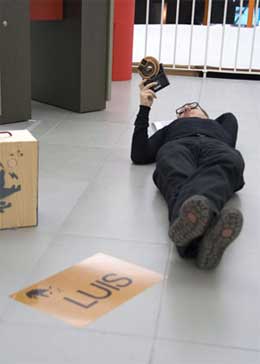 It was funny to watch people how exciting they became by obeying some very simple instructions, just for the sake of getting some points on a virtual screen. Some were lying on the floor (even the curator Erich Berger), standing against the wall for a minute or shouting out loud.
But with each game, it depends on the *player’s obedience* to the rules.
The readers are new bachelor machines to extend the Standard model game
console.
Originally we (in that case me and 3 more Ludic Society members – PM ONG, Fleshgordo and imonym in conjunction with marguerite charmante) thought about making a game through the whole exhibition- with objects tagged – which have certain behaviours — the visitors shall bring them to their “natural born home” of the Objects (OOH) which is stored in the RFID tag of the object…), we wanted to further develop Ludic Society’s urban games into a white cube test area.
Thanks Margarete!
Previous posts about the exhibition in LABoral: Homo Ludens Ludens – Play in contemporary culture and society, the Art of War.
An Atlas of Radical Cartography, edited by artists Lize Mogel and Alexis Bhagat (Amazon USA and UK)
The editors say: An Atlas of Radical Cartography is a collection of 10 maps and 10 essays about social issues from globalization to garbage; surveillance to extraordinary rendition; statelessness to visibility; deportation to migration. The map is inherently political– and the contributions to this book wear their politics on their sleeves.
An Atlas of Radical Cartography provides a critical foundation for an area of work that bridges art/design, cartography/geography, and activism. The maps and essays in this book provoke new understandings of networks and representations of power and its effects on people and places. These new perceptions of the world are the prerequisites of social change.
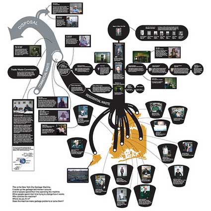
New York City Garbage Machine, by the Center for Urban Pedagogy
The slipcase contains a set of ten maps and a collection of essays by artists, architects, designers, and writers who illuminate the maps and explore their role as political agent. An Atlas is one of the most intelligent, thought-provoking and original publications i’ve read in a long long time.
First there is a purely aesthetic pleasure of unfolding the maps and discovering the careful, unique and innovative design of each one.
Then the essays are engrossing. They are written by people who have a story to tell you, they are passionate about it, they are angry or worried by the current state of affair but they are also smart enough to know that the best way to solve a problem is to adopt a pro-active attitude.
Right from the cover, showing an “upside-down”map, we are faced with the fact that even the most banal and innocent-looking map has its own agenda, that it is extremely difficult to separate cartography from politics and ideology. Far from being neutral accessories which would merely help you go from point A to point B, maps are often used as instruments for controlling and shaping beliefs. Conversely, maps can also be at the service of protest and social change. That’s what the contributors of the Atlas demonstrate. Deliberately, openly and quite convincingly.
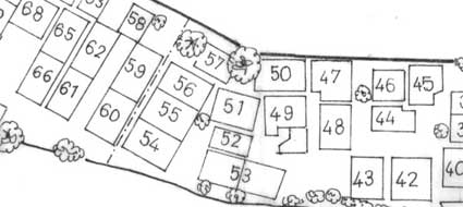
Unnayan | Chetla Lock Gate, Marginal Land Settlement in Calcutta, 1984 (detail)
The first map transports you a few decades ago in Calcutta (now Kolkata). Formed in the mid-late 70s, Unnayan was a civil activist groups which campaigned on dwelling, health, labour, schooling and various rights-related issues met by communities in urban and rural areas of eastern India. Unnayan was involved in projects that including preparing maps that identified settlements which existed in Calcutta at the time but were blanked out in officila maps. Elaborated in collaboration with the communities, the maps helped them locate water pumps, roads, but it also made these communities visible on a space which official maps would otherwise define as “vacant land.” The vast majority of these maps are destroyed by floods or stolen. Jai Sen, a member of Unnayan, reconstructs fragments of these experiments and puts them on record in Other Worlds, Other Maps: Mapping the Unintended City, his contribution for An Atlas of Radical Cartography.
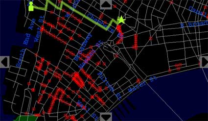
Institute for Applied Autonomy, iSee
All the other maps are contemporary.
The Institute for Applied Autonomy discusses tactical cartography and how locative media technology can be used by activists as cold and precise weapons to foster critical social engagement. They illustrate the concept by detailing their project iSee, a web-based application developed in collaboration with NYCLU and the Surveillance Camera Players to chart the locations of CCTV cameras in Manhattan. By checking iSee, users can find routes that avoid these cameras (“paths of least surveillance”) allowing them to walk around their cities without fear of being “caught on tape” by unregulated security monitors. Their essay explains how stories about the iSee application spread all over the media and generated a series of discussions and debates amongst a -so far- unsuspecting audience. The work also extended to camera-mapping workshops which assumed the double role of rendering the proliferation of surveillance cameras tangible to a general audience and creating an empirical basis for challenging policing and public safety policy.
Visible Collective/Naeem Mohaimen interviews Trevor Paglen about his investigation into extraordinary rendition flights, the tension between art and activism as exemplified by a look at Mark Lombardi‘s drawings and Ashley Hunt‘s maps, the reasons why cartography shouldn’t be confused with geography, etc.
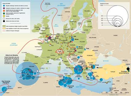
Olivier Clochard and Philippe Rekacewicz, Death at Europe frontiers
I found An Architektur‘s contribution to the book illuminating. Because of what i read in the media and because of the intense pleasure i experience when i am treated like a delinquent by the “immigration” officers each time my plane land in the U.S., i often have this vision that the U.S. is the evil one in the quest of security and border control. An Architektur, a collective that applies sociopolitical questions to space and architecture, proves me wrong by exposing the European Union’s efforts to tighten its borders against asylum seekers and people looking for a better life. Hence, the need to close hermetically the access to EU and to park inside a migration camp anyone managing to jump above the wired fences. An Architektur points to several maps which illustrate the issue such as Migreurop‘ s From European Migration and Asylum Policies. to Camps for Foreigners map (PDF), – Hackitectura‘s map that rethinks the frontier between Morocco and Spain, replacing the concept of border as space of separation with site of connection and reciprocal flow, etc. A striking example is the article and map called Death at Europe frontiers where Olivier Clochard and Philippe Rekacewicz document the death occurred while trying to reach the territory of the European Union. Only documented death are taken into account but their number goes way beyond the 7 000 between 1993 and 2006 (3 000 from December 2003 to 2006). The map shows that danger doesn’t stop when the border is crossed. Once inside the EU, migrants have to face racist attacks, unsafe working conditions for the illegals, police repression, internment camps, etc.
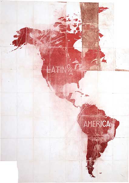
Pedro Lasch, GuÃas de Ruta / Route Guides, 2003/2006,
These were just a few lines about 4 of the maps and essays you’ll find in An Atlas of Radical Cartography. There’s also Pedro Lasch’s beautifully symbolic map of the America/Latin America relationships, Lize Mogel’s politically heavy re-lecture of the map of the San Francisco Bay Area, Jane Tsong’s children science textbook-style drawings which reveal what it takes to be able to turn on the tap in her bathroom, the Center for Urban Pedagogy’s well-documented New York City Garbage Machine describes the fight for power over the bins, Brooke Singer’s The US Oil Fix demonstrates the impact that the US addiction to fossil fuels has on the rest of the world and Ashley Hunt’s A World Map tackles the world capitalist system.
An Atlas takes also the form of a touring exhibition which is making a stop over unitl May 6, 2008 at Dowd Fine Art Gallery, SUNY Cortland, NY.
Related: Resistant Maps (part 1) – Introduction, Resistant Maps (part 2) – GuerrigliaMarketing.

Back from the 10th edition of ZEMOS98, a festival of audiovisual culture titled this year Regreso al futuro, Back to the Future. I wish all the events i attend were as intelligently curated, carefully organized and stimulating as this one. The audience was great too. And extremely polite: they sat all the way through the talk i gave there in a spanish bastardized with franco-italian words and grammar.
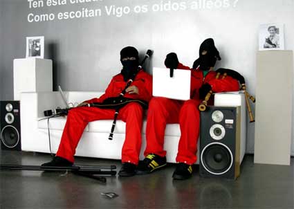
Image from the workshop Control Sonoro
There were workshops, concerts, presentations, screenings and talks. One of the highlights of the week for me was Lisa Parks‘ talk. Her lecture was part of Critical Powers which invited thinkers and creators to share their views on the possible functions of utopia in an era of advanced Capitalism, the effects of technology changes on cultural process, or on the power of a public sphere.
Lisa Parks, Ph.D., is Associate Professor of Film and Media Studies at UC Santa Barbara. She is the author of Cultures in Orbit: Satellites and the Televisual and co-editor of Planet TV: A Global Television Reader. Her research explores uses of satellite, computer and television technologies in a transnational context.
ZEMOS98 put a tiny extract of the presentation online:
And i’ll add my notes:
Introduction
The lecture was articulated around two themes (Spying and Dreaming) and was a small compendium of the many topics she has been working on over the past few years, most of the material she presented is based on case studies but for lack of time she merely glossed over them.
Her first slide showed us a list of satellites that Spain has ownership on. Most are used for remote sensing. The first one (intersat) was launched in 1974, the latest DEIMOS in 2008 which will be used for disaster management. Parks stressed the importance of developing more literacy about satellites. We can name tv channels and websites by wouldn’t be able to name satellites. Throughout history, hundreds of satellites have been launched into space.
Another of her key interests is the visualization of satellites. We can have an everyday tactile contact with other technologies like mobile phones or television sets but our experience of satellites is very different. Right from the start as satellites are a highly specialized technology. They have to be constructed in clean room, protected from the rest of the world and they are launched in locations which are often closed off for security purpose. Once they are sent into orbit, most of us will never think about them again.
Parks then talked about the footprint of satellites. No matter how clearly defined the boundaries of nations can be, their space will always be crisscrossed by footprints from different satellites launched by various countries. Spain uses satellite technology to beam its signal to Latin America for example. That’s what she calls “Nation Beaming”.
Spying
1. The Corona Project
The Corona Project was a top secret program run by the CIA with the help of the US Air Force. One of them was hidden in Discoverer Spacecraft which contained biological experiments (to check how plants would withstand being launched into orbit). The project was top secret and involved a huge capital investment that the public financed without ever knowing about it.
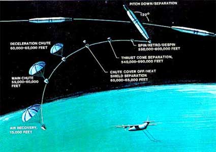
Corona film recovery diagram
Of the 144 Corona satellites launched, 102 returned usable images.
The Corona satellites secretly monitored and gathered a huge amount of satellite data about USSR, Eastern Europe and Asia from 1960 until 1972.
The program was declassified by President Clinton in 1995 and he made the images collected available to the public.
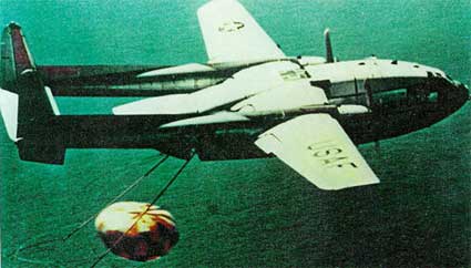
Catch of a Corona capsule off of Hawaii (image)
The recovery of the images taken by Corona was quite remarkable. A mechanism would drop the film canister and drop it in the air. The canister would then be recovered in mid-air by a C-119 aircraft. If the recovery mission failed, the canister would deploy a parachute and be recovered on earth or on the ocean.
The Corona program was initiated during the Cold War to check if “the other” was developing new weapons. The satellites were thus used to develop an image intelligence which would help the government decide on their own internal and external policy.
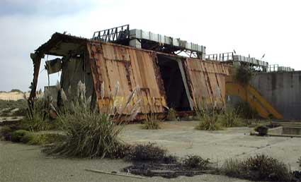
Corona launch preparation shed in ruins (image)
The Corona facility are now in decay.
2. Satellite imaging and global conflicts
It’s also important to discuss the relationship between orbit and earth in the age of image intelligence and see how remote sensing get integrated into news culture, how and when classified images suddenly make their way into our global media culture. More precisely the questions her research is focusing on are:
First case study: Rwanda
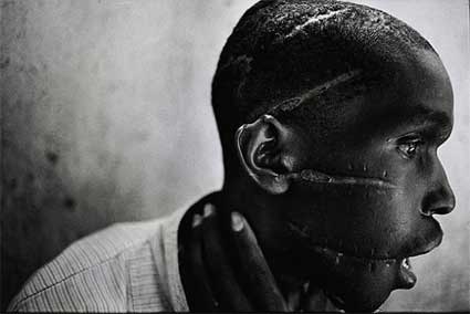
James Nachtwey, Survivor of Hutu death camp, Rwanda, 1994
Refugees International used aerial and sat images in 1996 to try to find and assist 1 million displaced persons. The combination of sat/aerial images was used as a medium that could uniquely visualize a “nationless social body”. The organization understood how these images could capture better than any other medium the displacement of a moving mass of people who have nowhere to go.
Many satellite images have to be inscribed with caption, without them the images lose their significance, they look like abstract paintings. We need to be directed to read these images.
Pressured US to release sat images to draw world attention to a conflict that was being ignored by the international community.
Second case study: Bosnia, July 1995
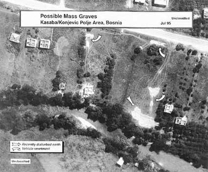
Satellite photo of Nova Kasaba mass graves.
US was boasting to have real time visibility over the war theatre – Information Dominance
Srebrenica is US-protected, highly monitored and as such regarded as a “Safe Haven”.
US State Department released sat images of alleged mass graves in Srebrenica 6 weeks after the massacre occurred.
Sat evidence of atrocities released after the fact, rather than during the act. The US State department claimed that the problem was that volume of sat data was to plentiful.
Case study 3. Colin Powell and Irak, 2003
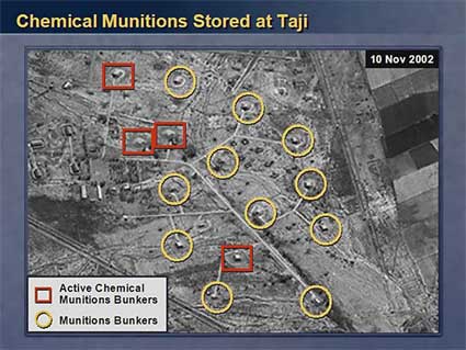
Slide 12 of Powell’s address
Powell presented sat images in his address to the UN Security Council to make the case for a US-led war against Irak, alleging they contained “undeniable proof” of Iraqi development of weapons of mass destruction.
From Lisa Parks vantage point the case raises a real problem as Powell not only plagiarized a PhD thesis but, more crucially, the whole story undermined the credibility of any future use of sat images by US official in a global forum.
Satellite images are digital images and have thus no physical reference, they are generated by a series of 0 and 1. Yet they are useful. One shouldn’t embrace them as state truth but as a field of investigation. The 3 case studies highlight how much has changed in the US after the Corona programme.
Institutional Changes
The privatization sector is led by European companies:
1983 SPOT (Satellite Pour l’Observation de la Terre) begins selling sat images – 10 m resolution, meaning that an object 10 m long can be visible from space.
1987 Soviet company Soyuzkarta joins the game. They charge $500 to $800 for images of 5 m resolution, a price affordable for States or corporations.
1994 Clinton administration privatizes remote sensing in the US. The technology can no longer be used solely by CIA and the scientific but can be tuned into a profi-making industry.
The privatization of remote sensing occurs throughout the ’80s and ’90s.
In the 1990s Earthwatch and Space Imaging emerge and sell images of 1 m resolution.
Today the website of Satellite Imaging Corporation claims that they are the largest because they are the one who possess most satellite assets. They own a fleet of satellite, one of them moves makes a complete turn of the Earth in 90 minutes.
The commercialization of sat images has led to some odd uses and requests.
In 2001, Dan Bollinger, a fan of the tv program Survivor: Africa, sent a request to Space Imaging to acquire the image data over the Kenya location and share them with other fans of the show. The CBS facilities were discovered but the tv channel didn’t want to see their production site exposed.
The images nevertheless traveled all over the world showing that satellite images are no longer a matter of security issue but are part of a broader visual culture.
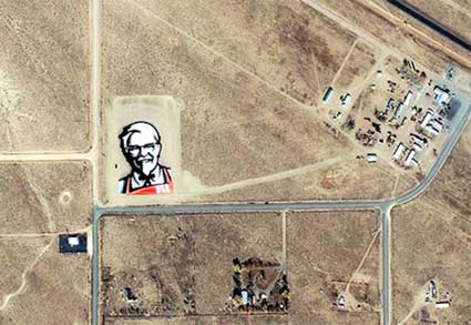
Another case which illustrates the previous statement come from a campaign by KFC. The fried chicken company needed to re-design the brand and came up with the “Face from Space” in the Nevada desert, also known as the “UFO Capital of the World.” The fast food company purchased an Ikonos image of the site and distributed it through global media circuits.
While satellites have historically passed over the earth to observe “naturally unfolding” phenomena, now events are staged precisely so they can be viewed from an orbital perspective. Remote sensing satellites are now being used to pitch products and address global consumers just as other media such as commercial television or the world wide web. More in this article by Lisa Parks: Obscure Objects of Media Studies: Echo, Hotbird and Ikonos.
Google Earth
Since 2005, Google Earth presents us with a “mosaic’ed” version of the world using satellite images coming from various sources. But while the logo of Google is always clearly visible on the images, no matter how blurry they are themselves, we are kept in the dark regarding the satellites used to compose these images. Google Earth is a great opportunity to educate the public about satellite but instead they do GE tends to almost erase the existence of the satellites.
Digital Globe provides date information for satellite images that are part of Google Earth using color-coded squares and “I” icons. By clicking on “preview,” you enter a meta-browser featuring the single satellite image captioned with information about how to purchase it or others from Digital Globe. Digital Globe is thus providing date information as part of a marketing strategy. GE becomes a billboard.
(image)
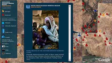
Google Earth teamed up with the United States Holocaust Memorial Museum to create the Crisis in Darfur mapping initiative which collects and diffuses visual evidence of the destruction in Darfur.
On the surface it looks like an admirable project but in several ways it missed the opportunity to represent the conflict in all its complexities. It uses tropes to represent African tragedy (images of suffering children carried by their mother). There is no visible effort of providing a political and economical education about the tragedy.
With the slide i pasted below, Lisa Park claims to demonstrate that earlier media news provided more opportunities for education:
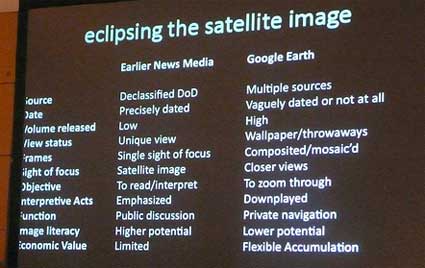
Problems of GE Crisis in Darfur layer:
– obscure satellite imagery,
– represents the “past perfect”, because it show what we monitored from space but didn’t do anything about at the time,
– involves the branding of global conflicts (no matter how blurry the image, the Google brand is always conspicuous),
– exemplifies neoliberalism (David Harvey) and disaster capitalism (Naomi Klein),
– from CNN effect to Google Earth effect? In order to get world attention will an event have to appear on Google Earth?
What does it mean for a US corporation to reproduce foreign territory as they want and without asking permission (some nations actually complained that GE causes a serious security concern.)
In a nutshell:
The public remains relatively uninformed about satellites, their uses and their impact on everyday life even though citizens taxes subsidize satellite developments.
The second part of Lisa Parks was about The Dreamers, the artists who use and comment on satellite technology. I found this part a bit weaker (less documented and with errors in the orthography of the artists’ names, happens to everyone of course but look quite bad on slides.) But here are a few notes:
“The Dreamers” encourage us to see and reflect about sat technologies and their potentials. they dare to experiment with satellites (traditionally seen as a heavy and highly specialized technology) and how they are used. Encourage us to think about who owns and control, satellites, orbital space and the spectrum. Develop uses that are not just about state security or corporate profits but about citizens’ needs.
Artists acknowledged in her presentation about satellite art and activism:
– Kit Galloway and Sherri Rabinowitz,
– Douglas Davis,
– Brian Springer,
– Marko Peljhan,
– Trevor Paglen,
and a special and enthusiastic mention of Aram Bartholl.
Last recommendations from Parks:
Contest the militaristic and corporate appropriation of satellites with more art, activism, dreaming and experimentation.
Imagine how the use of satellite in the public interest might be defined.
Image on the homepage showing Laika, a dog launched in orbit together with the satellite Sputnik II in 1957.
Can’t believe how late i am in publishing these notes about the Transmediale exhibition. I used to be a young, dynamic and super fast blogger, but that was a long time ago.
Although i always chose to focus on the good side of exhibitions and other events, i rarely have the opportunity to be so genuinely and totally enthusiastic about a festival. This was the media art festival i was dreaming of: a strong concept, an exhibition that does not confuse new media art with circus of interactivity and electro-gadgets for grown-ups, a conference that calls in so many inspiring artists, activists and researchers.
The theme? Conspire. How could you resist that one? While doing some research on conspiracy theories i passed from the expected to the utterly ridiculous (with a few nuggets in the middle). Conspiracy theories spread faster than ever with a little help of the internet and other communication technologies, but more importantly there is no doubt that we are definitely living an era where suspicion (or should i say paranoia?) reigns supreme.
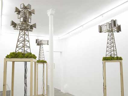
Matt O’Dell, New Worship, image courtesy galerie Schleicher+Lange, Paris
“Conspiracy is the ‘condition’ of our times,” told me Stephen Kovats, the Director of the festival. “When we consider information and network culture, when we look at the questions arising from the relationships between politics and culture particularly online … the loss of authorship – or perhaps authority or belief in universal truths … the weaving of narrative together with speculation and expanding the results at light speed, where anybody anyplace can become an expert or authority on any issue … that’s where the stuff of conspiracy is born. With transmediale, we were interested in exploring what this ‘condition’ in the era of digital mobility as a strategy, emotion, aesthetic, cultural state of being or landscape is.
One of the best moment of the festival for me was PN (Power Noise), a electrifying performance by Elpueblodechina and Zosen who turned the data grabbed from Bureau d’Etudes‘ Bohemian Map into noise.
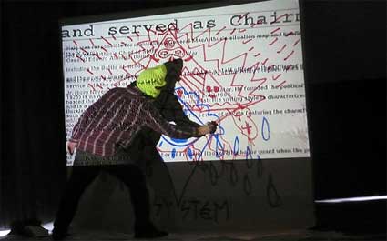
The Bohemian Map maps the connections and sphere of influence of some 2000 members of the Bohemian Grove, the high-profile annual Sonoma retreat of the Bohemian Club, a group that counts some of the most powerful men in the world. The club has counted every Republican president since Herbert Hoover as a member. Based in Paris, the Bureau d’Etudes group is engaged in the mapping of contemporary power relations at the institutional and international level.
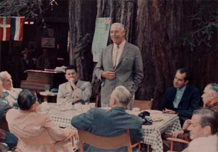
Breakfast at Owls Nest Camp, Bohemian Grove, July 23, 1967 (image)
Bureau d’Etudes (whose work i’ve been admiring for years even if i’ve never written about them so far, shame on me!) was participating to the Transmediale exhibition with one of their latest projects, the Laboratory Planet. While so far they were producing gorgeous large-scale posters that visualize structures of power and ownership which usually remains invisible, this project uses google maps to reveal the laboratory for experimentation that our planet has become. After the end of WW2, the Earth, along with all its living inhabitants, have become a huge site for all kinds of experimentations.
The development of convergent technologies (bio-, nano-, cogno-, info-, robo-, sociotech) is the magic circle in which biological and mechanical species emerge
from the laboratory and from new periodic tables. Much of this research is today carried
out in secret. That is why an understanding of the present itself remains determined by the limited insight that we can have concerning information which is itself filtered or orchestrated. How can we speak of the present ? How can we know where we are or understand the situation we find ourselves in ?
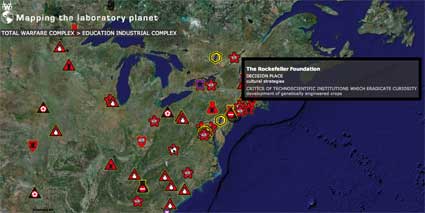
Laboratory Planet aims to be a data base which would give us both a broad vision of the phenomenon, but also a local one as you can check the map and see what is happening in your neighbourhood. It’s also an instrument that calls for the collaboration of the public to enrich its content.
More details in the PDF of the project.
The exhibition, guest-curated by NataÅ¡a PetreÅ¡in-Bachelez, requests some effort from the visitor. Nothing is right here right now, nothing comes to you easily, and even if you visit it equipped with the leaflet that describes each work, there are still a number of questions that you’ll have to investigate by yourself if you want an answer. This way of experiencing the projects fits perfectly the mysterious streak of the exhibition theme.
The show is organized around several “thematic constructs”, each of them explores a different facet of notions such as conspiratorial truths, bio-organic systems and twisted realities.
Back to the theories of conspiracy with Christoph Keller‘s project Chemtrails.

The Chemtrail conspiracy theory claims that some trails left behind jet aircraft are different in appearance and quality from those of normal contrails, may be composed of harmful chemicals, and are being deliberately produced, and covered up by the government. These unusual trails are referred to as “chemtrails”. Some researchers believe that a chemical and/ or biological agent of some sort is being released. The term “chemtrail” does not refer to common forms of aerial dumping – it specifically refers to systematic, high-altitude dumping of unknown substances for undisclosed purposes, resulting in the appearance of these unusual contrails.
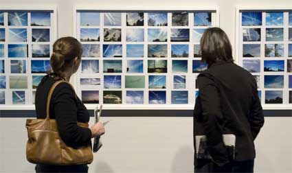
Photo: Jonathan Gröger
Keller’s work includes a video and a collection of photos taken by amateurs. Chemtrails uses the mysterious phenomenon to reflect on superstition and paranoia in the USA.
Wonder Beirut #1, Greetings from Beirut, 1998-2007
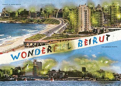
The first part of Wonder Beirut, by Joana Hadjithomas and Khalil Joreige, tells the story of a pyromaniac Lebanese photographer named Abdallah Farah.
Wonder Beirut #21, Beaches in Beirut, 1998-2007
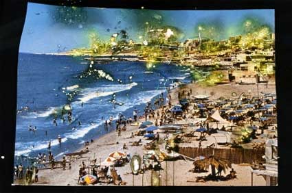
In 1968 and 1969 Farah took photos of the capital for the Beirut tourist authority intended to promote the city. The resulting postcards depicted an idealized Lebanon in the 1960s. The postcards are still on sale nowadays , although most of the places they represent were destroyed during the Lebanese civil war.
Latent Images, 1998-2007
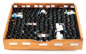
In the autumn of 1975, Farah started damaging the negatives of his postcards, burning them according to the destruction of the buildings he saw disappearing because of bombings and street battles.
The “Wonder Beirut” project shows the results of Farahs photographical and pyromaniacal work. Part of the project are also the notes of Farah documenting the photographs which he never developed because of the lack of fixative and photographic paper during the war years. By publishing and distributing these images, the artists try to fight the trend which puts the Lebanese civil war between brackets and includes the Lebanese conflict only marginally in the contemporary history. But is this postcard story a fact or a fiction? (more images.)
The story of Be Prepared! Tiger!, a project by Knowbotic Research in collaboration with Peter Sandbichler, starts with the discovery on the internet of a propaganda video by the Tamil liberation army which shows the glorification of a speedboat that was supposedly financed by North Korea. The boat is deliberately likened to the American F 117 stealth bomber, a myth of invisibility and invincibility. The artists gathered information inside different networks and through private contacts in order to re-engineer and rebuild the boat.
The boat is mysterious in its background, form and tests have shown that it remains invisible for radar systems. Yet, the boat can be seen with the naked eye, it is functional, and it is even a marketable good (the artists put it for sale on various websites.)
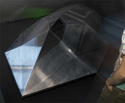
With their project, the artists play on the dialectics of visibility and invisibility present in many of our modern technologies, it stands for the ruses and tactics used to escape from the geo positioning and surveillance technologies of the 21st century.
Also part of the Transmediale exhibition: Chernobyl Project – Images of the Invisible, Amazon Noir – The Big Book Crime, Symbology.
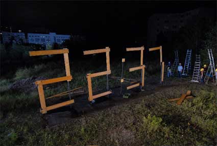
To amuse the crowd on their way to the restaurant, the absorbing Standard Time by Datenstrudel. A 24h clock/video showing 70 workers building somewhere in Berlin and “in real time” a wooden 4 x 12 m “digital” time display: a work that involves 1611 changes within 24 hour period.
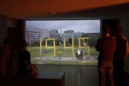
Photo Jonathan Gröger
The spectator looking at Standard Time does not only see the time, but also people tirelessly constructing it. Video.
And on the way from the restaurant to the bar…
5VOLTCORE‘s knife.hand.chop.bot uses a knife to s(t)imulate the test of courage – a kind of game known as “Five Finger Fillet”. The User puts his/her hand into the Machine and pushes the button. The knife starts to hit the space between the fingers, first slowly then continually getting faster. A sensor guides the Machine so it “knows” where to hit.
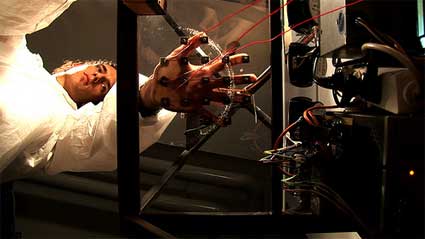
Electric contacts are activated as soon as the first “nervous sweat” is detected on the hand, the sweat turns the skin into a conductor. Disturbed by the electric current that is now transmitted via the skin, the computer changes behaviour: sounds are generated by the closure of the contacts (circuit bending) that can either be interpreted as warning or act as an additional source of stress. On the other hand, they can have an effect on the position of the knife which is controlled by the computer and thereby hurt the potential perpetrator of the disturbance.
All my images are online.
Situation Room, a project / prototype conceptualized and proposed / produced by hackitectura.net, is on view until March 17 at LABoral, an new exhibition, training and production centre for art, science, technology and advanced visual industries located in Gijon, Spain.
Situation rooms are places used in times of crisis to assess and monitor data for decision taking. These rooms are equipped with monitors and data boards to control everything from the Strait of Gibraltar to the nuclear fission processes in a nuclear power station or the life sustaining mechanisms on board the International Space Station. If i tell you that they are also called “control room” then all kinds of images from war, space and spies movies might come to your mind.
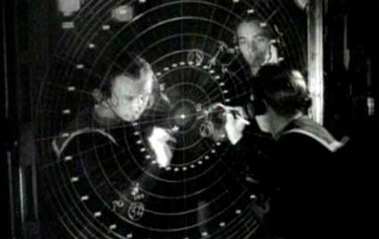
British Destroyer On-Board Glass Polar Plotting Board (via)
With the arrival of the Internet, a more open access to data collection and display technologies has enabled several experiences of Situation Rooms in civil society, with temporary media-labs mainly influenced by cybernetic ideas and free software.
Taking Asturias as a case study, Situation Room invites the public to participate in an open experiment-simulation of a situation room. The second goal of the project is to facilitate the production of common knowledge among artists, geographers, architects, biologists, economists, computer specialists, critics and the public, about the issues put forward.
I found the project so interesting that i asked the coordinator of the project, Pablo de Soto, if he had a few moments to answer my questions. In the meantime i realized that Pablo is a member of hackitectura.net, an activist group of architects, hackers and programmers, whose work i had been admiring for a couple of years. At the core of hackitectura.net are Sergio Moreno and José Pérez de Lama and Pablo. Their collaborative network undertakes practical and theoretical research into the emerging territories of information and communication technologies, new social networks and the traditional physical space.
Answers by both José Pérez de Lama aka Osfa and Pablo from hackitectura:
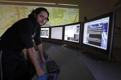
Situation Room. Image LABoral/Cárdenas
I actually discovered your work a few years ago at the festival Mal au Pixel in Paris where you gave a talk about Hackitectura. How does Situation Room builds upon the experience and projects Hackitectura.net have been developing since its creation? How does the project complete (or differs from) your previous works?
The project Situation Room is the distillation of the experiences made by hackitectura.net since 2003 in the design and implementation of several temporary media-labs: “Pure Data Beta Rave” in the abandoned AVE station in Seville, “Okupa Futura: Ciudad Disidente” in the Centro CÃvico Federica Montseny in Corvera de Asturias and “La Multitud conectada”, a media-lab with satellite connection in La Rábida Huelva (2003), Fadaiat: freedom of movement / freedom of communication in both borders of the Strait of Gibraltar (2004 and 2005).
The Multitud Conectada (“Connected Multitude”) was a prototype for a networked public space, produced for a network of activists, artists and technicians. Using technologies such as the bi-directional satellite connection, the wifi (in its infancy at the time) or the streaming with free software, -with real time connections to México, Bogotá or France-, we created a space which was both local and global, digital and analog.
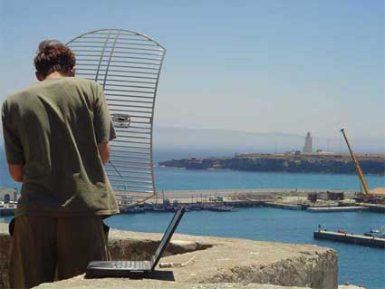
Dave Tarifa Psand pointing grid antenna to Tangier. No GPS device was used. Picture: osfa
In Fadaiat, which we developed in the framework of the Indymedia Estrecho network (an independent production platform and a bi-political production to which hackitectura actively participated), we developed the same concept but focused on the production of a cyborg geography (conception of spaces, social networks and electronic flux), which was located in a geopolitical node as peculiar and antagonistic as the frontier that separates Europe and Africa in the Gibraltar Strait. In Fadaiat, which held editions in 2004 and 2005, we had a distributed medialab, part of it was located in the Castillo de Tarifa (Spain) and the other in the Marshan, in Tánger (Morocco), linked between each other by wifi connection. Besides, this connection, set up by a network of technicians and activists from both parts of the Strait, was the first wifi connection ever made between the two continents, at least the first one managed by hackers and activists. We like to highlight how the link crossed a densely controlled and militarized space, a space with which we were trying to communicate in some way or another.
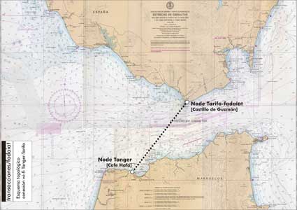
Planning of the wifi link, as sent to ITU Morocco for permission. Image:osfa
The SIVE (Sistema Integrado de Vigilancia Exterior / Integrated System of External Surveillance), which had started to take ground in the area since 2002, constitutes the first attempt to fortify the frontier with electronic tools, and Fadaiat was conceived as a kind of critical mirror to it.
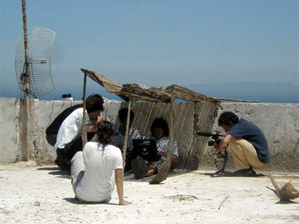
Media-lab Tangier. Daytime, fixing the link with Tarifa. Picture: hd_(((i))) bcn
More specifically Situation Room is the continuation of the temporary laboratory that hackitectura.net designed and implemented in GeografÃas Emergentes (“Emerging Geographies”, 2007), which took place near the nuclear power plant of Valdecaballeros, located in a Spanish region called Siberia Extremeña. Because of the social opposition, the power plant was put to a stop 25 years ago, before it even started functioning and since then it is abandoned, dominating a severe landscape made of steppes, like a post-nuclear ruin.
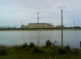
Valdecaballeros nuclear power plant (image)
Taking the challenge of the regional government which called for a development based on knowledge (we are talking about the first region in the world who chose to work with free software at an institutional level) and sustainability, we decided to simulate a takeover of the nuclear plant as a participatory lab in order to initiate a reflexion and come up with proposals regarding the re-use of the power plant in another economical and production context and from other subjects. The laboratory was located in the middle of the field, surrounded by sheep, but it was connected to the internet by a satellite antenna and equipped with computers and screening systems. A geodesic dome acted both as a shelter and as a screen for projections. Made of white textile, it worked from the inside as an immersive interface and from the exterior like a magic lantern in the middle of the night.
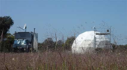
GeografÃas Emergentes, Geolab
The various events that took place in the lab (presentations, debates, workshops, performances) were broadcast live on the net and we also had remote participants via streaming.
An important element of GeografÃas Emergentes was the participation of young people from the area (a competition selected 10 projects to be implemented in the lab) but also of children and adults from Valdecaballeros who participated to workshop and festive events.
Situation Room, an attempt to combine the ideas of a media lab and media room, with practices of data-visualization, cartography and free streaming, aims to present previous experiences in a more artistic and institutional context.
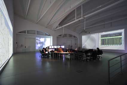
Situation Room. Image Marcos Morilla. Courtesy of LABoral
Which kind of data are you going to monitor during these two months spent in Asturias?
We understand the Situation Room at LABoral, more as a simulation than an actual device to scientifically mine and process data. The main information that we have been showing and discussing at least in the first part of the project, has been the presentation of the concept itself, its origins and proliferating use by command and control powers, and the potentials to hack situation rooms in order to make them perform with other goals.
Situation rooms are on the one hand, devices connected to complex contexts, where processes are non-linear. In order to take decisions and act in these situations, the different agencies (military staff, governments, business, police…) need to continuously monitor reality and establish a permanent feedback loop between it and their actions.
The processing of sets of data extracted from complex systems needs new ways of processing and evaluation, which have to do with cartography and data visualization. On the other hand, situation rooms are only meaningful if we understand them as embedded in networks, which comprise at least two main areas, a sensors area (that captures data) and an actuators area, which allows for strategies and decisions to be performed.
Our ideas where to use Situation Room as a space and time to discuss these issues, and particularly the possibility of turning them into a “multitudinar” device, that is the possibility to use them to empower the action of social networks, rather than central powers. How could situation rooms enhance distributed control. How could they be used to generate socially useful knowledge and to increase coordination between social movements.
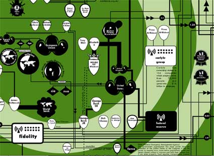
“Financial core,” Bureau d’études, World Monitoring Atlas (via)
One of the questions that we made ourselves is, then, what kind of data would such a situation room be interested in. In order to advance in this direction, we held a workshop with Bureau d’Etudes, the French team famous for their cartographies of capitalism, power and production. It seems somehow that before or beyond quantifying data, a situation room of this sort should produce different images of the system, that would enable other desires and goals. In this workshop we started studying different critical mapping projects, and after that participants – focusing on Asturias, the region where the workshop was happening -, made a list of possible mapping subjects (worked out of the ideas of nodal points, threats and opportunities). This allowed us to produce a preliminary map of the region, somehow a strategic map, that should guide future data mining – and could as well work as a communication and coordination tool.
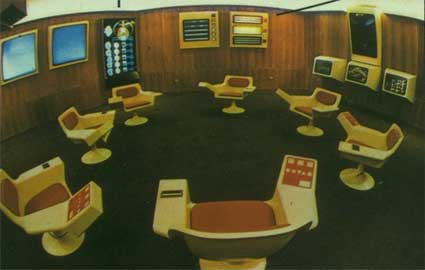
Installation Cibersyn operations room (image)
The second workshop dealt with a project which we feel very closely connected to ours, which is Cybersyn. Cybersyn was a network developed in Chile between 1970 and 1973 under the socialist government of Salvador Allende (Cybersyn was presented in Transmediale, right after Situation Room). A very young team of Chilean techs collaborated with British cybernetics pioneer Stafford Beer to develop a Chile-wide system to coordinate nationalized industries. The aim of the project, however, wasn’t to control factories and workers, but to regulate the network as a living organism, where autonomy of the different cells was compatible with the overall functioning of the organism. Of course, the right wing coup d’etat didn’t allow the project to be completed, but its promises are still of great appeal. One of the interests of this workshop was to realize the social potential of the concept – which astonishingly was designed almost simultaneously to Arpanet itself (1969). Rather than being afraid of control and technologies in general, we think that research and creativity should be applied to the social appropriation of them; we even think that the source of technological creativity, as Cybersyn shows, lies rather on social cooperation, and that is only later captured by the military or capitalism.
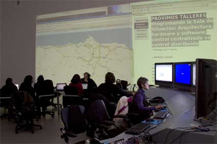
Situation Room. Image Julio Calvo. Courtesy of LABoral
Situation Room is a complex project which includes a series of workshops, a laboratory and the installation itself. What is the aim of the project? What do you hope to explore and learn with it?
We think one of our aims was to advance in the design of situation room that could be actually used in the context of social movements, for special events or for daily research, strategic planning and organizing. Somehow we understand that it should be rather a multiplicity interconnected of situation rooms, embedded in networks of “biopolitical labs” such as social centers and independent media and research groups. As we wrote in the presentation for the project, somehow anyone equipped with tv, Internet, mobile phone and computer, has a personal situation room at home, but we would like to go on researching how the combination of hacktivists medialabs, artists media rooms, multimedia communication, participatory cartography and emergent free software data mining and visualization technologies, could empower social action.
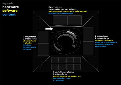
Situation Room, graphic from the first proposal
The presentation of the projects says that the public will be able to participate. How exactly can they get involved in the project?
In the first part of the event, we organized the two already mentioned workshops that were open to the public, and students in particular.
There was a small but intense participation, composed by artists, architects, techies and activists. In the opening sessions we had remote participants, from Barcelona and Malaga, whose images occupied one of the walls of the room. The sessions were streamed through GISS (a global free software network) making them available to anyone connected.
One of the results of the workshops was an interactive cartography of Asturias, based on meipimatic (a wikimapping platform developed by some Madrid friends). In the next weeks, meetings will be held with different local collectives, that are knowledgeable on particular issues such as ecology, labor, urbanism, etc, that we expect to join the mapping team. This groups will be invited as well to set up their temporary offices in the lab and use its resources.
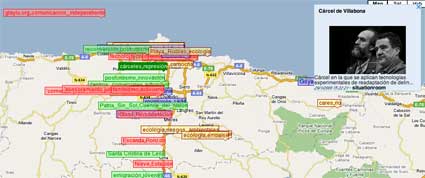
Open tactical cartography of Asturias
The general public is also invited to contribute to the map.
Another way of rather automated participation is through rss feed. Feeds form relevant media, especially independent, are processed and permanently projected in several of the large screens in the lab, presenting a panorama of current issues in Asturias.
Eventually, there will be several workshops with children. Activities will include access to data bases, introduction to data visualization technologies and creation of data bases and maps to be visualized in the Situation Room. Children’s contributions would be incorporated as well to the Asturias meipimatic.
Thanks Pablo and osfa!
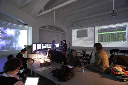
Situation Room. Image Marcos Morilla. Courtesy of LABoral
Situation Room is the winner of the first convocation of the LABjoven Experimenta Contest at LABoral in Gijon, Spain.
One more from the work in progress exhibition at the Royal College of Art in London.
Tuur Van Balen, student of Design Interactions turned his attention to drinking water.
Water service companies add fluoride to the water to reduce tooth decay, in the UK, in the US and other countries. It has also been said that the army in some countries added bromide to drinking water in order to quell sexual arousal amongst male soldiers. Male fish in some area turn female because the oestrogen in birth-control pills ends up in the river.
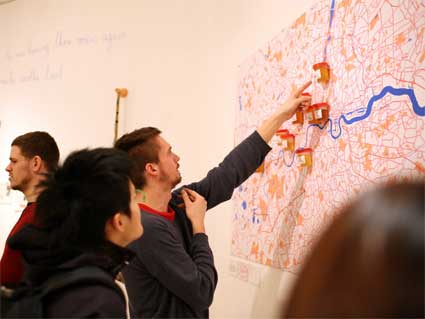
My City = My Body is part of ongoing research into future biological interactions with the city and more precisely into how the increasing understanding of our DNA and the rise of bio-technologies will change the way we interact with each other and our environment.
The first chapter of this exploration of new biological interactions is dedicated to Thames Water, London’s largest ‘drinking water and wastewater service company’. Making use of the work-in-progress-show at RCA, he offered tap water (kindly provided by Thames Water) and asked visitors to donate a urine sample along with their postcode. He added the samples and postcodes to a map of London which contains biological information.
Because i liked his project a lot and wanted to make sure i wouldn’t write anything too silly about it, i asked Tuur to give us more details about his research. I’m passing the microphone to him:
The installation / intervention in the show is part of a bigger, ongoing project called My City = My Body. I’m interested in how cities are not as much made up by streets and buildings as they are made up by our behaviour and experiences. (The London of a design-student, cycling around from Shoreditch to South-Ken is totally different from the London of a banker in a black cab with his blackberry and a loft in Notting Hill) These experiences are heavily mediated by technology, just look at the way mobile communication networks totally reshaped our cities.
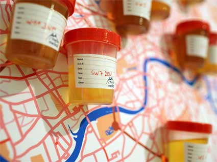
What I’m interested in, is how future technologies might influence our urban behaviour. We’re on the verge of a new area, an area that relies on the understanding of our body and the understanding of our DNA. What does this mean for the cities of tomorrow? Will we have DNA-surveillance and discrimination? Bio-identities and communities? …
The biological map in the interim show was an ‘intervention’ using the show as a platform to get feedback on these ideas. By gathering urine samples, I want to make people think about how their biological waste contains information. Pissing in public might become like leaving your digital data up for grabs, spitting in the streets like leaving your computer unprotected on the internet.
Unfortunately, I was not allowed to test the urine samples in the show. As England is the Mecca of Health&Safety, it was a struggle which took me up to Senior Management to even exhibit my project in this form (“Bio-hazard, sir!”) Continuing this research, I’m trying to contact a laboratory to look at bacteria, how bacteria could be a possible way of transforming our biological waste into information (inspired by Drew Endy‘s BioBricks project) and what the consequences in our everyday lives could be…
Thanks Tuur!
Images of the project courtesy of Tuur van Balen.